Kursy
- Trainer/in: Andreas Brück
- Trainer/in: Gesa Henning
- Trainer/in: Julia Anna Kowalska
- Trainer/in: Nija-Maria Linke
- Trainer/in: Georg Müller
- Trainer/in: Andreas Brück
- Trainer/in: Julia Anna Kowalska
- Trainer/in: Georg Müller
- Trainer/in ohne Editorrecht: Sophia Lina Zwietasch
- Trainer/in: Nina Bäckström
- Trainer/in: Andreas Brück
- Trainer/in: Julia Anna Kowalska
- Trainer/in: Georg Müller
- Trainer/in ohne Editorrecht: Sophia Lina Zwietasch
COMMUNICATION & ADVANCED SPATIAL ANALYSIS (CASA) deals with new analysis and support tools that are needed to guide policy, planning, and design in urban environments that face large climate impacts, differences in impacts across social groups, and uncertainty in decision-making processes for more sustainable urban development and adaptation/transformation.
VISUALIZATION in Urban & Regional Planning: Today & Tomorrow Advanced methods for recording and processing (spatial) data to depict current conditions (incl. data analysis, cartography, and GIS) as well as methods of future exploration and scenario techniques (incl. computer-aided modeling and representation - e.g. 3D rendering, BIM, VR)
The elective module in the Master's program gives students the opportunity to deepen their knowledge of (mainly computer-aided) methods of ANALYSIS & PROGNOSIS in urban planning / urban design, and to enhance their skills and become familiar with further methods. It builds on knowledge acquired in bachelor studies but is also intended to teach advanced methods to students who have not previously completed the BA SRP at ISR.
Preconditions:
It would be helpful to have QGIS and Google Earth Pro installed on your computer before starting the course. It should be noted that in order to use Google Earth Pro, the student must agree to use Google products on their device.
Preferably to use Windows OS, however, you can use macOS or Linux as well.
Link QGIS: https://qgis.org/download/
Install version: Standalone from OSGWO4W package QGIS 3.34 (Long-term version) according to your Operative software (OS) and Memory Ram ( 32 or 64 bits).
Installation manual: https://docs.qgis.org/3.34/en/docs/user_manual/
Link Google Earth desktop: https://earth.google.com/intl/earth/download/ge/agree.html
Format: In-Person
Level: Medium
Mx. Participants: 30
Expectations and objectives:
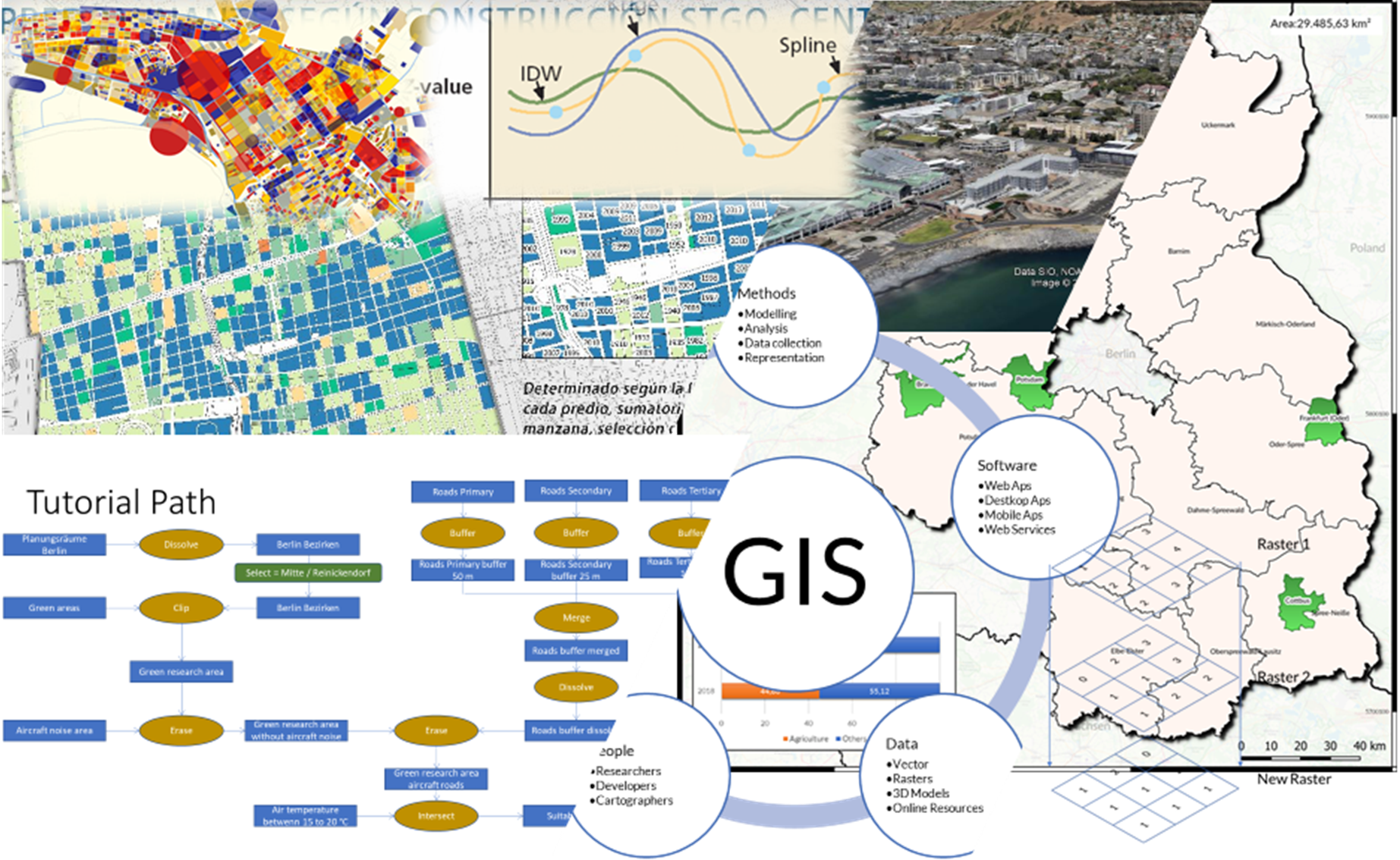
It is expected to develop basic knowledge of GIS structure & methods. Introduction to GIS softwares, Geoviewer and app such as QGIS, Google Earth, R, Geoda, Master Portal (Geo-Online), Qfield. Be able to apply the GIS knowledge for solving analytical problems in urban topics.
Topics:
1.-Introduction in Geographical Information Systems
2.- Vector Data - generate - edit vector data
3.- Coordinate systems, projections and image georeferencing
4.- Working with attribute table, create and edit data
5.- Introduction to Qfield – Google Earth Pro- Master Portal
6.- Database & Joins. WMS sources & internet sources
7.- Geoprocessing tools and spatial analysis using vector data
8.- Map Products
9.- Map Products 2
10.- Spatial analysis using raster data
11.- Advanced spatial analysis using raster data
12.- Modelling approach- PYQGIS- Introduction to R- Geoda
Topics of this handout should be used as a quick guide and should never take the place of assignment guidelines or instructor directions and/or preferences.
The material will be updated according to the corresponding session.
- Trainer/in: Andreas Brück
- Trainer/in: Nija-Maria Linke
- Trainer/in: Georg Müller
- Trainer/in: Felipe Andres Vergara Ovando
- Trainer/in ohne Editorrecht: Julia Anna Kowalska
- Trainer/in ohne Editorrecht: Sophia Lina Zwietasch