Kurslar
Many individuals in today's world are growing up with a natural familiarity with smartphones and almost constant access to the internet. This is causing a shift in how they perceive and utilize urban spaces. While some scholars discuss the emergence of portable private spaces that enhance public spaces, others assert that people are withdrawing from public spaces, immersing themselves entirely in digital realms. In light of these developments, this seminar delves into the concept of cyber-physical spaces, which are understood as spatial arrangements where physical environments and digital applications converge, as well as hybrid spatial practices that operate at the intersection of digital devices and physical surroundings. The objective of this seminar is to define cyber-physical spaces and hybrid spatial practices, distinguish between different types of cyber-physical spaces, and explore various forms of hybrid spatial practices. Ultimately, we aim to derive planning and design insights from these explorations. This holds significance for both the field of planning practice and scientific inquiry, as the use of mobile devices is poised to have an even more profound impact on our spatial perception and practices in the future. Understanding cyber-physical spaces and hybrid spatial practices is therefore crucial for the development of user-centric, sustainable public spaces. The seminar is offered in both in-person and online formats, organized as a block-time event. It encompasses theoretical studies through reading and discussions, as well as empirical research conducted in the field.
- Trainer/in: Andrea Bluhm
- Trainer/in: Angela Million
- Trainer/in: Paula Pretsch
- Trainer/in: William Banjo Armstrong Scobie
- Trainer/in: Sophie von Woedtke
The Scientific Colloquium supports and accompanies the process of writing a master thesis. It provides guidance with identifying and refining the research question as well as developing an appropriate research design or research plan. In a series of joint workshops with the root disciplines (Architecture, Urban Planning, Landscape Architecture and Sociology) questions of the right methodology or methodological mix for the specific requirements of the individual thesis project are discussed. The course is comprised of block seminars, with the introduction held on 4th December.
- Trainer/in: Andrea Bluhm
- Trainer/in: Angela Million
- Trainer/in: Anna Neuhaus
- Trainer/in: Hendrik Schultz
- Trainer/in: William Banjo Armstrong Scobie
- Trainer/in: Jörg Stollmann
- Trainer/in: Sophie von Woedtke
In many parts of the world, using bikes, walking, and public transportation are seen as important ways to reduce pollution from motorized traffic, which contribute to climate change by being alone responsible for 23% of global greenhouse gas emissions. However, it's not always easy to make this shift to greener transportation because cities lack the right infrastructure to support it. One solution that's gaining attention is using nature-based solutions, like restoring natural areas and creating green spaces in cities. These approaches, called Blue-Green Infrastructure (BGI), can help make transportation eco-friendlier and more enjoyable. Integrating green infrastructure defined by European Commission as “A strategically planned network of natural and semi-natural areas with other environmental features, designed and managed to deliver a wide range of ecosystem services (ES), while also enhancing biodiversity”, within urban mobility contexts is in fact among the most widely applicable, economically viable and effective tools to combat the impacts of climate change. Indeed, the 2020 ‘European Green Deal’ by European Union (EU)[1] and the 2015 Smart City Mission by the Government of India[2], reflects the significance of BGI both in Global North and Global South contexts for combating the dual goal of restoring degraded ecosystem and providing efficient, safe and environmentally friendly transportation system.
The permanent Zoom link for all the online and hybrid classes is:
https://tu-berlin.zoom.us/j/69638685149?pwd=YmpvM3FiUnVhbzFjVEpSS08yMXhCdz09
The design studio will focus on reimagining BGI from the perspective of people
who are on the move. We want to explore how linking BGI to spaces of
transportation can make the experience better for pedestrians, cyclists, and
public transportation users. By considering the needs and
preferences of pedestrians, cyclists, and users of public transportation, this
class seeks to design inclusive and sustainable mobility pathways that offer
environmental benefits, improve well-being, and create more enjoyable urban
experiences.
The class will work with a comparative and most contrasting analysis and design
approach exploring European and Indian city cases, considering their unique
contexts and challenges. Studying both shall bring forward the complexities of
urbanization and people’s needs as well as the range of urban design and
planning strategies required to address diverse urban challenges. Contrasting
contexts are also to inspire practical and context-specific solutions which
will be developed for a Berlin Case. The studio exercise will adopt research by
design approach.
The students will gain practical experience through an excursion/study trip to India in February 2024 and/or the participation in a spring school in March 2024 in Germany.
Objectives of the studio class are:
· Rethink blue-green infrastructure (BGI) from the perspective of individuals in motion, considering pedestrians, cyclists, and users of public transportation.
· Explore how the integration of green infrastructure can enhance the mobility experience, making it more engaging, comfortable, and connected with nature.
· Investigate the potential of blue-green pathways to improve air quality, provide shade, reduce noise pollution, and create visual and sensory appeal for moving individuals.
· Analyze the challenges and opportunities of integrating green infrastructure into different types of mobility networks, including sidewalks, bike lanes, public transportation corridors, and shared spaces.
· Develop design interventions and strategies that seamlessly incorporate green infrastructure elements into mobility pathways, prioritizing safety, accessibility, and user preferences.
· Consider the long-term benefits of blue-green pathways, such as climate resilience, biodiversity support, and community well-being, and explore ways to communicate these benefits to the public.
Note: The studio class is part of a nationwide collaboration among universities in urban planning, urban design, and architecture, supported by the National Urban Development Policy (Nationale Stadtenentwicklungspolitik) "Fachlicher Nachwuchs entwirft Zukunft": www.tu.berlin/isr/fnez. This collaboration aims to foster the professional development of future experts in the field and envision sustainable urban futures.
- Trainer/in: Nina Bäckström
- Trainer/in: Andrea Bluhm
- Trainer/in: Daria Kariakina
- Trainer/in: Angela Million
- Trainer/in: William Banjo Armstrong Scobie
- Trainer/in: Megha Tyagi
- Trainer/in: Sophie von Woedtke
Drei Jugendliche sitzen auf der Lehne einer Parkbank. Alle drei schauen auf ihre Smartphones. Zwei von ihnen teilen sich Kopfhörer. Sie unterhalten sich sporadisch. Sie wischen mäßig interessiert über ihre Bildschirme. Plötzlich lachen alle drei auf, obwohl zuvor kein Wort gesprochen wurde. Ein kurzer Wortwechsel zur Frage, wo man einen Happen essen könnte. Konzentrierteres tippen auf den Smartphones. Kurze Rücksprache. Es folgt der zielgerichtete Aufbruch.
Junge Menschen wachsen heute völlig selbstverständlich mit Smartphones und (fast) kontinuierlichem Internetzugang auf. Dies verändert wie sie Stadträume wahrnehmen und nutzen. Während die Einen plötzlich ständig durch die Stadt stromern und Pokémons fangen, ziehen Andere sich aus öffentlichen Räumen zurück und tauchen völlig in digitale Welten ab. Bestimmte Ecken in der Nachbarschaft werden angesteuert, da Nutzer:innen-Bewertungen im Internet die Qualität einer Imbissbude mit 4,8 von 5 Punkten bewerten oder weil über Online-Portale Angebote für Straßensport beworben werden.
Vor diesem Hintergrund befasst sich das Projekt mit sogenannten cyber-physischen Räumen – verstanden als räumliche Arrangements bei denen physische Umwelten und digitale Anwendungen verschmelzen – und hybriden Raumpraktiken, die an der Schnittstelle zwischen digitalen Endgeräten und physischen Umwelten funktionieren.
Ziel des Projektes ist es cyber-physische Räume und hybride Raumpraktiken konkreter zu definieren, Methoden zu ihrer Erforschung zu testen, unterschiedliche Typen cyber-physischer Räume sowie verschiedene Formen hybrider Raumpraktiken gegeneinander abzugrenzen und schließlich hieraus planerische Implikationen herauszuarbeiten. Dies ist für Planungspraxis und -wissenschaft gleichermaßen relevant, da die Nutzung mobiler Endgeräte unsere Raumwahrnehmung und unsere Raumpraktiken zukünftig noch intensiver als bislang prägen werden. Cyber-physische Räume und hybride Raumpraktiken zu verstehen, ist daher wichtig, um nutzer:innen-orientiert zukunftsfähige öffentliche Räume gestalten zu können.
Gearbeitet wird in drei Phasen: (1) Theorie & Praxis, (2) Empirie, (3) Planerische Interventionen. Jede Phase beginnt mit einer Kleingruppenarbeit, bei der selbstständig Inhalte erarbeitet werden, die der Projektgruppe anschließend vorgestellt werden. Darauf aufbauend werden mit der gesamten Projektgruppe jeweils übergeordnete Erkenntnisse herausgearbeitet. Zusätzlich geben Gastredner:innen Einblick in ihre Arbeit in diesem Forschungsfeld.
Phase 1: Theorie & Praxis | Zum Einstieg in die Projektarbeit wird Literatur zum Thema ausgewertet sowie erste Beobachtungen im öffentlichen Raum durchgeführt. So soll einerseits ein theoretisches Verständnis der Thematik entwickelt werden und andererseits ein Abgleich mit dem Alltag in urbanen Nachbarschaften durchgeführt werden. Die Aufbereitung der Erkenntnisse erfolgt nicht primär textlich, sondern auch und insbesondere grafisch (z. B. über Infografiken).
Phase 2: Empirie | Im nächsten Schritt werden unterschiedliche methodische Zugänge zur Erforschung cyber-physischer Räume und hybrider Raumpraktiken getestet: unter anderem wird eine Mapping-App („Map Republic“) genutzt, Videoaufzeichnungen mit Subcams (Mini-Kameras, die auf Augenhöhe getragen werden) aufgenommen sowie Interviews geführt. Die Studierenden werden hierbei einerseits autoethnografisch arbeiten – also ihren eigenen Alltag beforschen – und andererseits auch Dritte in die Forschung einbeziehen. Schließlich werden die sehr unterschiedlichen Materialien integriert analysiert. Im Ergebnis soll unser Verständnis cyber-physischer Räume und hybrider Raumpraktiken geschärft werden, indem unterschiedliche Typen cyber-physischer Räume sowie verschiedene Formen hybrider Raumpraktiken (im Sinne eines fortschreibbaren Katalogs) definiert werden. Sie werden grafisch und textlich charakterisiert.
Phase 3: Planerische Interventionen | Abschließend stellen wir uns der Frage, was wir aus unserer Forschung für die planerische Praxis lernen. Für verschiedenartige öffentliche Räume werden Stegreif-Entwürfe entwickelt. Abschließend werden gemeinsam übergeordnete Hinweisen für die Gestaltung öffentlicher Räume abgeleitet.
ECTS: 12 LP
Raum: SE-RH 006 (ISR-Atelier)
Tag + Zeit: wöchentlich montags, 14:00 bis 16:00 Uhr
1. Termin: 23.10.2023
- Trainer/in: Andrea Bluhm
- Trainer/in: Anna Juliane Heinrich
- Trainer/in: Daria Kariakina
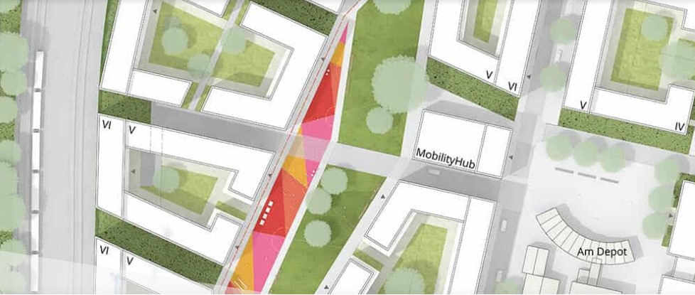
Im Rahmen der Übung sollen die Fähigkeiten, städtebauliche Qualitäten und Eigenschaften zu erkennen, zu analysieren und zu bewerten erlernt werden. Darauf aufbauen wird konzeptionelle Arbeit und selbstständiges städtebauliches Entwerfen – als Zusammenspiel intuitiven und analytischen Handelns – geübt und praktiziert.
In Kleingruppen werden eine konkrete städtebauliche Situation analysiert, Ideen und Leitbilder entwickelt und Gestaltungsansätze abgeleitet. Die Erarbeitung der städtebaulichen Konzepte und Entwürfe erfolgt in Einzel- und Gruppenarbeiten. Die Entwurfstätigkeit wird durch Teilübungen, fachliche und methodische Inputs und Werkstatttage unterstützt. Es werden unterschiedliche Darstellungsformen (u. a. Handskizzen, CAD, Modellbau) angewendet. Die Kleingruppenarbeit wird über Konsultationen begleitet. Im Rahmen der Veranstaltung werden die Zwischenergebnisse präsentiert, diskutiert und bewertet.
Diese Veranstaltung baut auf die Veranstaltung "B8 Städtebauliches Entwerfen und Gebäudekunde // Visuelle Kommunikation und Darstellungslehre" auf und ist Teil eines Pflichtmoduls für Studierende der Stadt- und Regionalplanung in Bachelor.Keine Gasthörer*innen zugelassen.
- Trainer/in: Felix Bentlin
- Trainer/in: Andrea Bluhm
- Trainer/in: Anna Juliane Heinrich
- Trainer/in: Daria Kariakina
- Trainer/in: Angela Million
- Trainer/in: Paula Pretsch
- Trainer/in: Sophie von Woedtke
- Trainer/in: Kira Joline Wollenweber
- Trainer/in: Sophia Lina Zwietasch